

Mapping the heritage of the River Culm
Rivers have played a central role in the development of our landscape, but their history rarely receives much attention. This project, led by Fjordr, will make information on the archaeology and history of the River Culm more accessible to people responsible for managing our watercourses and help raise public awareness of riverine heritage. Historic England is funding the project as part of its Heritage Protection Commissions Programme.
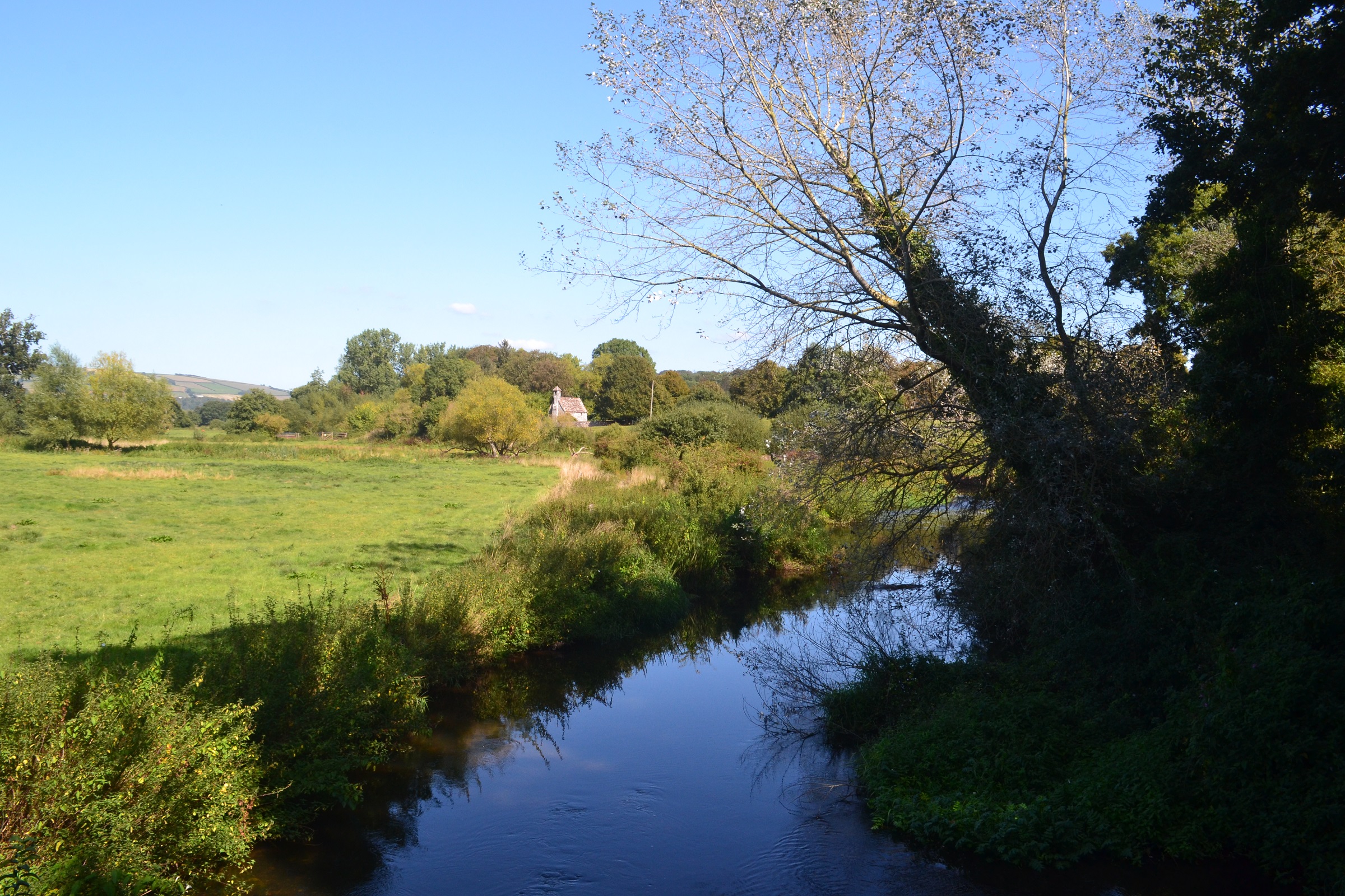
River Culm at Columbjohn looking towards the historic riverside chapel. Photo: Fjordr
The project is applying a methodology developed on the Dorset Stour for identifying the historic character of watercourses.
The River Culm is a tributary of the Exe. It rises in the Blackdown Hills Area of Outstanding Natural Beauty (AONB) and flows through Somerset and Devon.
We are working closely with Connecting the Culm, which is a three-year project to make the River Culm and its floodplain more resilient to flood and drought, improve water quality, support biodiversity and habitat, and involve local people and organisations in the process.
The River Culm Historic Character project is providing information to Connecting the Culm about how the river has changed from early prehistory to the present-day, using evidence such as historic maps, archaeological records and LIDAR data. The results will help in understanding how problems have arisen on the Culm and identify potential improvements that work well with the historic landscape.
Fjordr will also identify places where local people can get involved in discovering the history of the river and contribute to its future sustainability through the Connecting the Culm project.
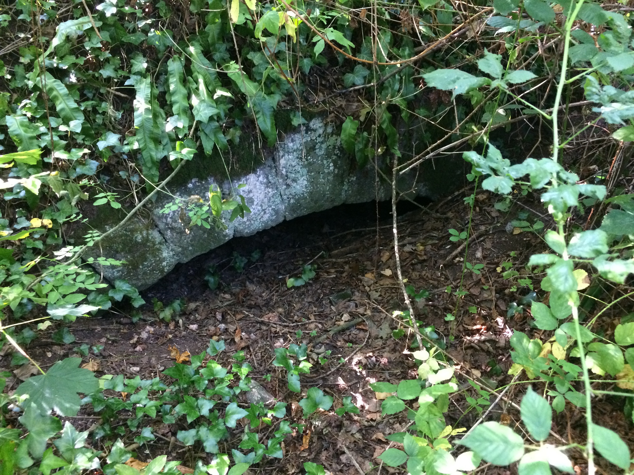
The arch of an old mill leat, where it ran under a long-vanished watermill on the River Culm. Photo: Fjordr
Our focus is on archaeological remains within and immediately adjacent to the river. We are also looking at changes to the river’s route and form as a result of human activity in the past. We are considering every aspect of river-based activity in the past, including mills, watermeadows, navigation, waterfronts, historic bridges and so on.
The River Culm is a key feature of the historic landscape and provides evidence of how the river has been used and altered over many centuries.
The River Culm Historic Character project is framed around Defra’s Catchment Based Approach (CaBA). As a result, we are looking at the whole Culm catchment including its tributaries, with a special focus on zones identified by Connecting the Culm for their work.
The principal output from the River Culm Historic Character project will be single GIS layer (digital map) that highlights features and areas that reveal the history of the river, with a brief description and references to the original source material for each element that is mapped. It will be made available to organisations involved with the river for them to use when planning works or activities. Experience from applying this methodology to the River Culm will also feed-in to projects looking at the history of other rivers.
If you have information about the archaeology and history of the River Culm and would like to get in touch then please email info@fjordr.com.
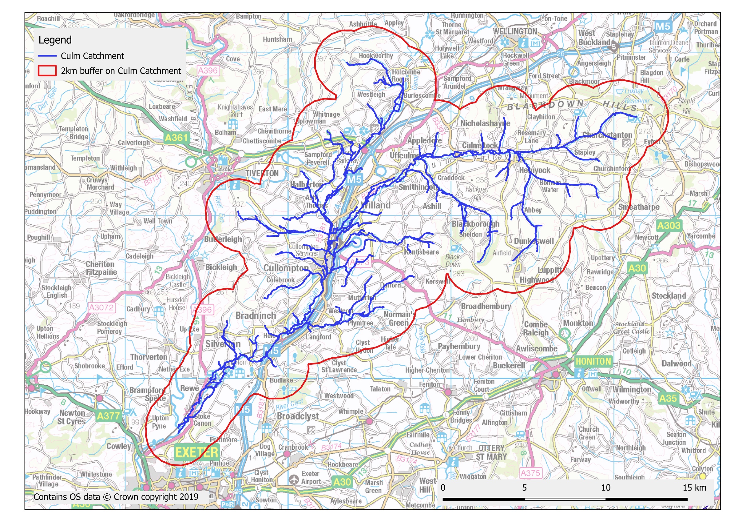
The extent of the River Culm catchment being investigated in the River Culm Historic Character project


