Medium difficulty. Distance 19 miles (30.5 km)
A moderate ride with one challenging uphill climb and several moderate uphill sections. Along the way, you’ll see a lakeside nature reserve, the seat of a former prime minister, and maybe a pot of gold! One of eight cycle routes in the Blackdown Hills National Landscape – Route 7.
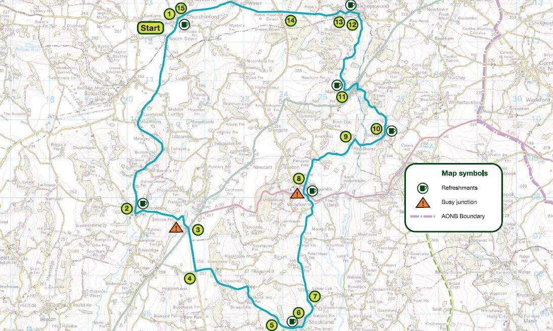
Main route (1 – 15)
1 Turn left out of the car park and follow road for 4 miles to Upottery
2 Turn left, signposted Chard, just after the Sidmouth Arms
3 At crossroads use dedicated cyclist crossing to southwest of road junction, cross over the main road, signposted Stockland, Axminster
4 Turn left, signposted North Hill at Rising Sun Cross
5 At junction turn left into Stockland
6 Turn left at Stockland Village Cross
7 Turn left at Road Ends Cross, signposted Yarcombe and follow for 2 miles
8 At junction turn left on to the main road, and then first right, signposted Marsh, after Yarcombe Inn
9 At junction (Sheafhayne Cross) turn right, signposted Howley, Chard
10 Turn first left after Howley Tavern, and follow under the bridge into Marsh
11 Turn right after the Flintlock Inn (just before no entry signs) and follow for 1.5 miles
12 At fork in road, bear right down hill
13 At junction turn left into Bishopswood
14 At crossroads go straight over, signposted Churchinford, Hemyock
15 At junction in Churchinford turn right and right again into car park
Maps: This route is based on OS Explorer maps and is intended as a guide to cyclists. Refer to Explorer 128 or Landranger 192 and 193 when planning your visit.
General Information: For information about safe cycling and further information to help plan your visit, see www.blackdownhillsaonb.org.uk
Although every effort has been made to ensure the accuracy of the route directions and descriptions, responsibility cannot be accepted for any errors or omissions. If you discover any errors, please let us know.